





















Doi Inthanon’s Tallest Single-Tier Drop—Far from the Tour Buses
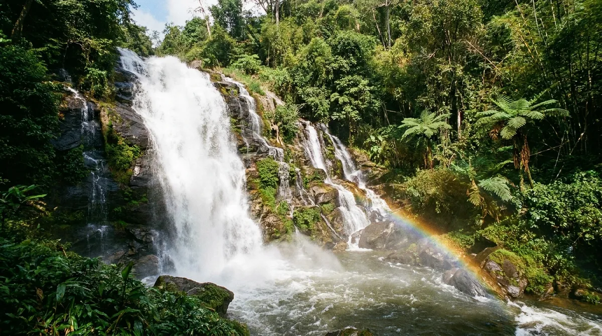
Nine out of ten travelers on a standard Doi Inthanon day trip snap photos beside highway-side Wachirathan Waterfall and never realize a taller, wilder giant thunders behind the Mae Chaem ridge. Dropping roughly 100 meters in one unbroken vertical plunge, Mae Pan Waterfall is the highest single-tier cascade inside Doi Inthanon National Park, framed by dripping moss, wild ferns, and thick cloud-forest canopy.
Because Mae Pan sits within park boundaries, you need a valid Doi Inthanon National Park ticket—2026 rates are 300 THB per foreign adult (150 THB child), 60 THB per Thai adult (30 THB child), plus 30 THB per car or 20 THB per motorbike. There is no secondary ticket booth at the trailhead itself; simply present the receipt you paid at the main checkpoint earlier in the day, making Mae Pan easy to pair with Kew Mae Pan Nature Trail.
Finding the Highway 1192 Turnoff & Huay Sai Lueang Combo
Reaching the trailhead requires turning off the summit highway before climbing to Thailand’s highest peak:
- Exact Route: Drive Highway 1009 up Doi Inthanon to Checkpoint 2 around kilometer 38, then turn left onto Highway 1192 toward Mae Chaem. Follow winding mountain curves roughly 6 km down to the clearly marked ranger station turnoff for Mae Pan / Huay Sai Lueang, then descend a steep, narrow paved lane to the parking clearing. Use low gear on the descent.
- Two Waterfalls from One Parking Lot: Right beside the parking area, an easy 50-meter stroll brings you to Huay Sai Lueang Waterfall—a broad, photogenic cascade over stepped granite ledges. From that exact same clearing, the rugged trail dives deeper into the forest for roughly 800–1,000 meters to reach Mae Pan itself.
Planning Your Chiang Mai Trip? Book Early for Lower Rates
Check real-time rates and secret deals on Agoda, our official travel partner. Enjoy 100% free cancellation, pay at check-in, and earn Agoda Cash rewards.
Trail Reality Check: ~1 km of Steep Roots, Mud & Spray
Let me be blunt about footwear: do not attempt Mae Pan in flip-flops or smooth street sneakers. Unlike paved city park walkways, this roughly 1 km one-way trail (nearly 2 km round-trip) drops steeply through raw earthen switchbacks, knotted tree roots, bamboo steps, and damp boulders.
- Descent (15–20 minutes): Steady downhill walking under deep canopy; after rain, red clay turns slick enough to demand constant attention and steady grip on wooden railings.
- The 100-Meter Viewing Basin: At the bottom, cold spray blows straight across the wooden pavilion and riverside rocks, misting camera lenses within seconds while the roar drowns out conversation.
- Climb Out (20–25 minutes): Returning uphill wakes up your calves quickly. Carry a small bottle of drinking water and take unhurried breathers along the benches.
Dry vs. Monsoon Safety & Transport Tips
Monsoon Season (July–October): Mae Pan pours at peak thunderous volume, and neighboring Pa Pong Piang rice terraces shine emerald down Highway 1192. However, deep mud makes the trail genuinely hazardous after downpours, and sudden mountain flash floods can turn the plunge pool deadly—never enter the swirling pool beneath a 100-meter drop during high water, and respect any ranger closure signs.
Cool Season (November–February): Unquestionably the finest trekking window—clear, vigorous water flow paired with firmer dry trails and crisp highland air. Hot Season (March–May): Flow shrinks significantly, though deep forest shade still keeps the gorge tolerable.
Since public songthaews and Grab cars rarely serve this remote Mae Chaem spur road, review our Chiang Mai transportation guide to hire a reliable private car or experienced scooter rider, and unwind afterward at Tha Phae Gate stays or Ping River hotels back in town.
Plan Your Chiang Mai Journey · Verified Booking Partners
Compare real-time rates for stays, curated day tours, flight tickets, and transport with best price guarantee and flexible cancellation: