








The Mountain Circuit Legend: The Thrill of the 100km Samoeng Loop
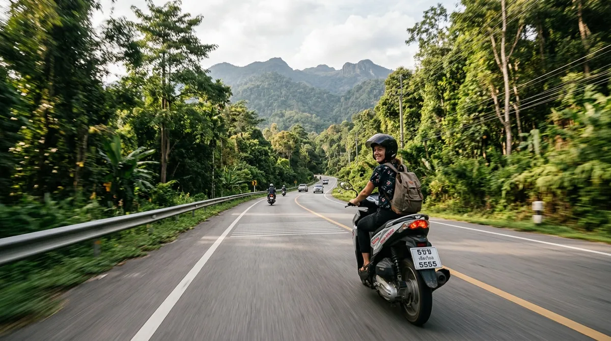
Ask seasoned motorcyclists across Southeast Asia to name Northern Thailand’s most accessible yet spellbinding mountain day ride, and the chorus answers with singular conviction: The Samoeng Loop. Encircling the vast, cloud-cloaked granite massif of Doi Suthep-Pui National Park, this legendary 100-kilometer ribbon of smooth asphalt weaves through three distinct districts: Mae Rim, Samoeng, and Hang Dong.
Having ridden these mountain passes since they were nothing more than rutted red-clay logging tracks, I have watched the Loop transform into a motorcycling paradise of sweeping cambered bends and panoramic vistas. Yet behind its scenic beauty lie hundreds of technical mountain corners that demand disciplined riding technique. To ensure your two-wheeled journey is an exhilarating nature adventure through Chiang Mai’s wilderness rather than a stressful ordeal, Uncle Kham has compiled this practical 2026 riding guide (you can also cross-reference our classic companion piece, the Samoeng Loop road trip guide).
Direction of Travel: The Strategic Virtue of Riding Clockwise
While the loop can be traversed in either direction, Uncle Kham unequivocally advises tackling it in a clockwise orientation:
- Morning Leg (Mae Rim): Fresh, dewy morning mountain air makes navigating the Mae Sa Valley an absolute joy, allowing you to visit botanical sanctuaries and enjoy riverfront espresso before temperatures rise.
- Midday Plateau (Samoeng Town): You arrive in the peaceful agrarian valley of Samoeng at midday—the perfect juncture to savor authentic northern chicken noodles, sample sweet highland strawberries, and refuel your tank.
- Afternoon Descent (Hang Dong): Climbing through high pine passes and cresting the Samoeng Forest Viewpoint in the afternoon treats you to golden horizontal sunlight illuminating deep jungle ravines before coasting down to the plains.
Planning Your Chiang Mai Trip? Book Early for Lower Rates
Check real-time rates and secret deals on Agoda, our official travel partner. Enjoy 100% free cancellation, pay at check-in, and earn Agoda Cash rewards.
The 4 Stages of the Loop: Landmarks & Route Dynamics
Leg 1: The Mae Sa Valley Ascents (Highway 107 to 1096 - 30km)
Departing the Old City northward along Chotana Road (Highway 107), you enter Mae Rim and swing left onto Highway 1096. This sector serves as the arterial backbone of any classic Mae Rim valley day excursion. The road hugs the tumbling Mae Sa torrent, flanked by shaded cafe terraces and bamboo forests. Notable turn-offs include Mae Sa Waterfall, Queen Sirikit Botanic Garden, and the steep winding ridge leading to the breathtaking terraced farming panoramas at Mon Cham mountain viewpoint.
Leg 2: The Forest Ridge to Samoeng Valley (Highway 1096 - 25km)
Leaving commercial attractions behind, the tarmac climbs steeply into dense indigenous cloud forests. Sweeping radius curves give way to technical hairpins before dropping into the sleepy agricultural bowl of Samoeng district. Famous as Thailand's primary winter strawberry basin, Samoeng feels wonderfully detached from urban hustle. Pull into the central town square for a hearty bowl of tom yum soup, and ensure your motorbike tank is topped up to full capacity at the local pump.
Leg 3: Samoeng Forest Ridge Lookout (Highway 1269 - 20km)
Swinging eastward onto Highway 1269 toward Hang Dong, the tarmac ascends another rugged ridge. The undisputed centerpiece of this leg is the Samoeng Forest Viewpoint. Perched upon a soaring shoulder overlooking endless blue mountain silhouettes, this rest stop features small local stalls serving local hill-tribe Arabica coffee and dried fruits. Take a mandatory 20-minute breather here to allow your motorcycle brakes and tires to cool.
Leg 4: The Serpentine Hang Dong Descent (Highway 1269 to 121 - 25km)
The final quarter delivers exhilarating downhill carving through dense bamboo canopies and rock gorges. The road eventually levels out at the Samoeng Intersection in Hang Dong, where you turn left onto the Canal Road (Highway 121) for a relaxed, flat, high-speed cruise back toward the city gates.
Motorcycle Safety Dynamics & Mountain Riding Discipline
Riding mountain passes safely requires specific biomechanical awareness:
- Preventing Catastrophic Brake Fade: The most dangerous mistake on mountain scooters is dragging the brake levers continuously down long declines. Friction generates intense heat that boils brake fluid, causing the levers to pull dead against the handlebars. Employ pulsed cadence braking—squeeze firmly for three seconds to shed momentum, then release. On automatic scooters, feather the throttle slightly to keep the centrifugal clutch engaged, utilizing natural engine compression to hold back the bike.
- Lane Discipline Around Blind Bends: Never drift across the center line. Local pickup trucks and agricultural haulers frequently utilize the full road width around narrow corners.
- Scanning for Road Debris: Be vigilant for loose gravel, runoff sand, and damp leaves strewn across corner apexes, particularly following afternoon mountain squalls.
- Pre-Ride Machine Inspection: Ensure tire treads are deep, pressures are accurate, both brake pads have ample thickness, and your headlamp operates cleanly. Always wear a snug-fitting full-face helmet and a protective abrasion-resistant jacket.
The Samoeng Loop is not about racing against the clock; it is a communion with the rugged mountain contours and scented pine breezes of Lanna. Ride with reverence, savor every vista, and return with a heart recharged with alpine wonder.
Plan Your Chiang Mai Journey · Verified Booking Partners
Compare real-time rates for stays, curated day tours, flight tickets, and transport with best price guarantee and flexible cancellation: